The Close-in Wild: A Quarter-Hour Audit for After-Work Adventure
It’s 4:47 on a Tuesday. The light is already going soft, the dog is giving you that look, and the nearest national forest is a 40-minute drive if traffic behaves. The big trip is not happening. But something can.
The usual advice for micro-adventures leans hard on the word “micro,” as if the point is to shrink the experience until it fits between meetings. I’d argue the opposite: the close-in wild is not a lesser version of the real thing. It is the real thing at a scale most of us can actually sustain. A quarter-hour radius, walked often, teaches you a place in a way a once-a-year pilgrimage never will.
What follows is not a bucket list. It’s an audit—a way to find the pockets of public ground, creek corridor, and unmarked green space near home that are legal to reach, pleasant to walk, and close enough to become routine.
Start With the Water, Not the Wow
Forget the summit. Start with the drainage. Creeks, gullies, and river bottoms are the connective tissue of any landscape, and they often thread through public land, county parks, utility corridors, and old greenways in ways that a road map never shows.
Open a USGS topo layer and a county GIS parcel viewer side by side. Look for the blue lines first, then the green shading, then the places where the two overlap. A national forest boundary might dip close to a subdivision. A state wildlife management area might sit behind a row of warehouses. A city greenway might connect to a larger piece of county open space through a half-mile of woods.
Satellite imagery is the reality check. Zoom in. Look for a gravel pullout, a gate, a mowed path, a footbridge, or a fence line. If the only access is through someone’s side yard, it’s not access. If the green shading is actually a golf course, keep looking.
The Three-Layer Map Check
A useful audit runs on three layers, and you need all three before you put on your shoes.
Ownership. Who manages the land? National Forest, BLM, state wildlife area, county park, municipal greenway, land trust, or private? Each comes with its own rules. A national forest is generally open to dispersed walking; a state wildlife management area may require a permit or limit access during hunting seasons; a city greenway may close at dusk. Know which one you’re stepping onto.
Access. Is there a legal parking spot? A trailhead, a pullout, a shoulder wide enough for two tires? Is the gate open after work? Does the easement allow public foot traffic, or is it a utility right-of-way that technically isn’t yours to use?
Reality. Satellite imagery and recent street-level photos will tell you more than any app’s trail layer. Look for posted signs, chain-link, fresh grading, or a “no trespassing” sign at the entrance. If the sign says no, it means no. Wildness is not an excuse to ignore property lines.
When in doubt, call the land manager’s office. A two-minute phone call can save you a citation and an awkward conversation.
A Kit That Lives by the Door
The biggest barrier to after-work outings is friction. Solve it with a small bag that never gets unpacked.
Mine holds a headlamp, a light rain shell, a water bottle, a handful of nuts, a tiny first-aid kit, a sit pad, and a paper map folded to the relevant square. In winter I add a beanie and a spare pair of gloves. In summer, bug spray. That’s it. No expedition sled, no stove, no heroic packing ritual.
Dress for the weather you have, not the weather you want. The point is to walk out the door, not to optimize a system. A headlamp matters more than you think once the sun drops behind the ridge at 5:15.
The Twenty-Minute Rule
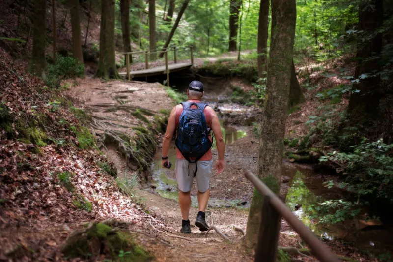
Pick a route that takes roughly 20 minutes to reach a turning point. Walk out. Turn around. Walk back. Add a buffer for gawking, photo-taking, or sitting on a log. That’s your outing—40 minutes of walking, maybe an hour door to door.
The first time, you’ll feel like you’re not going anywhere. Good. You aren’t. The second time, you’ll notice the same bend in the creek, the same leaning oak, the same deer trail cutting through the grass. By the fourth or fifth visit, the place starts to feel less like a route and more like a room you know.
That repetition is the whole argument. The annual big trip is a highlight reel. The after-work walk is the friendship.
Access Is the Adventure’s Edge
A close-in wild audit only works if you respect the edges. National forests near town are often patchworks of public and private land. State wildlife management areas may allow hiking but restrict it during certain seasons. County greenways may be open at dawn and locked at dusk. Some utility corridors are legally walkable; others are not.
Wear blaze orange during hunting seasons where it’s required. Pack out what you bring in. Give wildlife room. Keep your dog leashed where the rules say so. None of this is bureaucratic noise—it’s what keeps these small pockets open for the rest of us.
What You’ll Actually Find
You probably won’t find a sweeping vista. You’ll find beaver sign along a creek, a great blue heron lifting off from a bend, cottonwoods holding the last of the light, cold air pooling in a shadowed ravine, a fox track in mud. You’ll find the particular quiet of a place that is not remote but is, for a few minutes, yours.
That’s not a consolation prize. It’s the practice. The wild gets closer when you stop treating it like a destination and start treating it like a neighborhood.
This week, pick one blue line on the map. Check ownership. Find a legal place to park. Walk 20 minutes out and 20 minutes back. Then do it again next week. The quarter-hour wild is waiting, and it doesn’t care what time dinner is.