Low Water, Wide Margins: How to Read a Reservoir in Drawdown
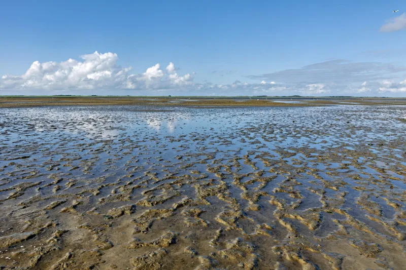
Every late fall, water managers start moving water around. They hold it back, let it go, and somewhere in the middle of that arithmetic, a reservoir shrinks away from its summer shoreline. The result is a wide, pale margin of mud, gravel, stumps, and old roads that wasn't there a few months ago. It can look like an invitation. It can also look like a mistake.
This is the season of the exposed shore. On reservoirs across the country—from big Reclamation projects in the West to Corps of Engineers lakes in the Midwest and Southeast—drawdowns create a temporary kind of wild place. Not wilderness, exactly. More like a borrowed edge. The water is lower, the map is different, and the rules haven't gone anywhere.
The line on the map is not a gate
A reservoir's elevation is the first thing to check, and it's usually easier to find than people think. Most managing agencies publish current pool elevation, the target elevation for the season, and sometimes a graph showing where the water sits relative to full pool, conservation pool, or flood pool. Those terms matter. A lake drawn down for flood control is telling a different story than one drawn down for irrigation or dam maintenance.
Look at the number, then look at the boat ramps. Ramp status is a practical translation of the elevation graph. If the ramp is high and dry, the water has moved. If it's extended, someone planned for the shift. Either way, the old high-water line—the faint stain or band of bare ground above the current surface—is your best visual cue for how much shoreline has been revealed.
The catch is that the high-water line is not a property boundary. Public land around a reservoir is managed by an agency, and that agency's boundary is usually fixed on a map, not drawn in mud. The exposed bed may be federal, state, tribal, or private depending on the reservoir and the section of shore. Low water doesn't change who owns what. It just makes the question easier to ignore.
Get the ownership layer before you get the view
This is the part where a little screen time saves a lot of trouble. Before you drive to a reservoir with a newly exposed shoreline in mind, pull up the managing agency's map—Bureau of Reclamation, U.S. Army Corps of Engineers, National Park Service, Forest Service, BLM, or a state wildlife agency. Then look for the ownership layer, not just the recreation layer.
You're checking for a few things: legal access points, closed areas, tribal land, private inholdings, and any seasonal restrictions. Reservoirs are patchworks. A shoreline that looks continuous from the water can be a series of parcels with different rules. Some exposed flats are open to foot traffic. Some are closed to protect habitat. Some are private land that happens to be under water for part of the year.
Download the map before you leave. Cell service at the water's edge is a running joke for a reason. A paper map or an offline GPS layer is not overkill; it's the difference between a walk and a trespass.
Walking the margin without wrecking it
The exposed shore is fragile in ways that aren't always obvious. Mud can look firm and then swallow a boot to the ankle. Banks can undercut. Submerged stumps and old fence lines become trip hazards. Wind across a wide, empty reservoir can turn a calm afternoon into a chop that makes the far shore look closer than it is.
Go slow. Stay off steep banks. Skip the temptation to drive past the pavement unless you've confirmed that motorized use is legal and the surface is stable. Mud season on a drawdown flat is not the place to test your tires.
And leave the artifacts alone. Low water exposes foundations, old roads, equipment, and sometimes things that are older than the dam. Federal law protects archaeological and historic sites on public land, and collecting artifacts is not a souvenir habit—it's a legal problem and a loss for everyone else. Look, take a photo, move on.
What the low water is telling you
There's a reflective angle to all this that's hard to miss once you've walked a few drawdown shorelines. A reservoir is a public land project with a water level that goes up and down on purpose. The wild edge moves. The map stays put. The exposed shore is a reminder that the landscape we call fixed is often just a snapshot of a management decision.
That doesn't make the exposed shore less worth visiting. It makes it more interesting. You're seeing the working parts of a system—water storage, flood control, hydropower, irrigation, recreation—all laid out in mud and gravel. You're also seeing how quickly a place can change and how much of its character depends on a number on a gauge.
A short pre-trip checklist
- Check current elevation and the seasonal target. Compare them to full pool.
- Confirm who manages the land and where public access begins.
- Download an offline map with ownership layers.
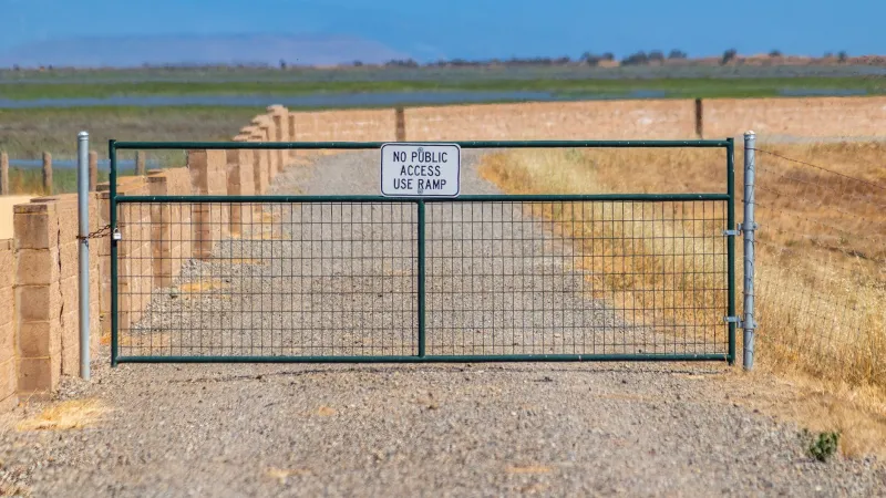
- Pick a legal route in and out, and don't improvise past gates or signs.
- Check wind, weather, and water temperature. Cold water is cold water.
- Bring traction and a way to clean up. Mud is the main character.
- Pack out everything, including the stuff that isn't yours.
The drawdown shore won't last. By spring, the water will climb back and the margin will disappear under a new line. That's the deal with borrowed places. You get to walk them for a while, read what they're saying, and then let the water take them back.